


Lewiston, Idaho has a portion of their downtown that was built below the flood stages of the Clearwater and Snake Rivers. Historically levees have been used to keep the rivers from inundating their downtown. The levees work to keep the rivers out, but when it rains during high river season the storm water has no place to go.
The City wanted to apply for grant money to help alleviate the problems. J-U-B helped them perform the initial analysis and prepare maps to show the potentially affected areas to include in the grant application.
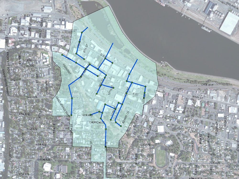
J-U-B completed the fast-track analysis for the City of Lewiston to include as part of a FEMA Hazard Mitigation Grant. A storm water model was used to establish inundation areas and to determine base flood elevations for various businesses and properties in the City’s 9th Street sub-basin. Project engineers converted the previous model from HYDRA to InfoSWMM dividing sub-catchments as required to obtain appropriate detail for the analysis. To minimize design costs, J-U-B worked closely with City survey to verify system elevations. Inundation areas were mapped and a mitigation plan was developed. The resultant recommendations of the report eliminated a railroad and bypass road storm water crossing at significant savings to the City.
Project Highlights:
- Converted previous HYDRA model into InfoSWMM
- Met FEMA Hazard Mitigation grant program requirements